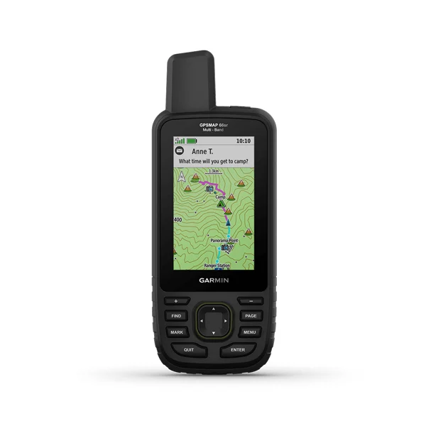
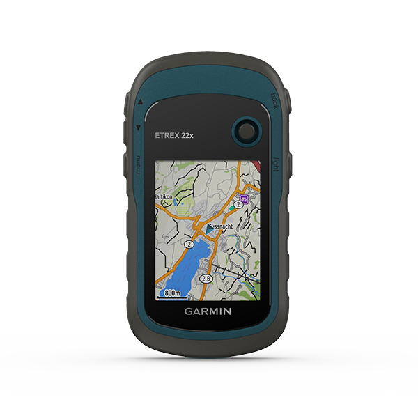
Whether you’re hiking, hunting, climbing, geocaching, kayaking or mountain biking, explore more by using this premium, rugged handheld with a 3” color display, preloaded maps and multiple frequencies for our most accurate position to date.
OVERVIEW
SPECIFICATIONS
DATASHEET
ACCESSORIES
⦿ EXPANDED GNSS SUPPORT: Multi-band technology and expanded GNSS support (GPS, GLONASS, Galileo, QZSS and IRNSS) provide optimal accuracy in steep country, urban canyons and forests with dense trees.
⦿ ABC SENSORS: Navigate every trail with ABC sensors, including an altimeter for elevation data, barometer to monitor weather and 3-axis electronic compass.
⦿ BIRDSEYE SATELLITE IMAGERY: Download high-resolution photo-realistic maps directly to your device without an annual subscription. Easily find trails, pick stand locations, find parking, create waypoints and more.
⦿ ACTIVE WEATHER: When paired with your compatible smartphone, you can get real-time forecast information and live weather radar, so you’re aware of the surrounding conditions.
⦿ Physical dimensions: 2.5″ x 6.4″ x 1.4″ (6.2 x 16.3 x 3.5 cm)
⦿ Display size: 1.5″W x 2.5″H (3.8 x 6.3 cm); 3″ diag (7.6 cm)
⦿ Display type: transflective color TFT
⦿ Weight: 8.1 oz (230 g) with batteries
⦿ Interface: high speed micro USB and NMEA 0183 compatible
⦿ Storage: 16 GB (user space varies based on included mapping)
⦿ Battery life: Up to 36 hours OR Up to 450 hours in expedition mode